Your snowboarding source for Snoqualmie Pass.

Alpental Cam

Snoqualmie Pass Weather:

Weather Alerts:

Thursday, December 30, 2004

Shovels

Life Link:


shovel$43.99

Ice Pro Fixed Length
3D Composite - Built tough and backed by a lifetime guarantee, the Ice
Pro Fixed Length 3D Composite shovel has an assembled length of 25 inches, making it the shortest and lightest shovel in the Ice Pro line. A compact shovel that's good for building shelters, shaping snowboard ramps and digging in rescue situations, this durable shovel features a stiff composite blade that's ideal for chopping. The curved scoop and smooth surface minim
izes sticky snow buildup. The two holes in the blade are for Life-Link's Slingblade carrying system for shovels and probes (sold separately).

mammut shovelMammut:

$64.99

The Mammut Expert Snow Shovel is a robustly constructed light metal avalanche shovel with excellent performance ratings. Its telescopic style means it can be adjusted to several different positions. It handles well thanks to its fat T grip that’s easy to hang onto. The aluminum shovel blade is durable and tough on hardened snow


dakine shovelDakine
SnowClaw Backcountry:

$14.95


This shovel has two separate edges
designed for shoveling either hardpack or powder snow. It fits into all Dakine technical pack shovel pockets. The slots in body allow for multiple attachment options. It Can also be used as a snow anchor or seat. This shovel also boasts that it is
crack resistanc to -29C.

emergency shovelPlastic Car Shovel:

$9.99


Conditions

New Snow: 3.5"

Air Temp: 31ºF
Humidity: 98%
Surface Temp: 33ºF
Dew Point: 30ºF
Elevation: 2984ft/910m
Wind Speed: 0mph
24hr High/Low: 33.00/30.00
Wind Direction: NE
Forcast:

TONIGHT
RAIN LIKELY THEN CHANCE OF SNOW AFTER MIDNIGHT. SNOW ACCUMULATION 1 TO 2 INCHES. SNOW LEVEL 2000 FEET. WEST WIND IN THE PASSES AROUND 10 MPH IN THE EVENING BECOMING LIGHT.


THURSDAY
SNOW SHOWERS LIKELY. SNOW ACCUMULATION UP TO 2 INCHES. SNOW LEVEL 2000 FEET. AFTERNOON PASS TEMPERATURES AROUND 30. EAST WIND IN THE PASSES AROUND 10 MPH.


THURSDAY NIGHT
MOSTLY CLOUDY. SNOW SHOWERS LIKELY. SNOW LEVEL 1500 FEET. EAST WIND IN THE PASSES AROUND 10 MPH.


FRIDAY
MOSTLY CLOUDY. CHANCE OF SNOW SHOWERS. SNOW LEVEL 2500 FEET. AFTERNOON PASS TEMPERATURES IN THE UPPER 20S. EAST WIND IN THE PASSES 10 TO 15 MPH.


FRIDAY NIGHT
SNOW LIKELY. SNOW ACCUMULATION UP TO 2 INCH. SNOW LEVEL 2000 FEET. EAST WIND IN THE PASSES 10 TO 15 MPH.


NEW YEARS DAY
SNOW LIKELY. SNOW LEVEL 500 FEET. AFTERNOON PASS TEMPERATURES IN THE MID 20S.

Wednesday, December 29, 2004

Conditions

New Snow: 0
Base Depth :12

Air Temp: 31ºF
Humidity: 98%
Surface Temp: 32ºF
Dew Point: 30ºF
Elevation: 2984ft/910m
Wind Speed: 3mph
24hr High/Low: 37.00/29.00
Wind Direction: E

Forcast:

SNOW LIKELY. SNOW ACCUMULATION 1 TO 3 INCHES. SNOW LEVEL 3000 FEET. AFTERNOON PASS TEMPERATURES AROUND 30. EAST WIND IN THE PASSES AROUND 10 MPH SHIFTING TO WEST IN THE AFTERNOON.


TONIGHT
MOSTLY CLOUDY. CHANCE OF SNOW. SNOW LEVEL 2000 FEET. WEST WIND IN THE PASSES AROUND 10 MPH SHIFTING TO THE EAST AFTER MIDNIGHT.


THURSDAY
SNOW SHOWERS LIKELY. SNOW ACCUMULATION UP TO 1 INCH. SNOW LEVEL 2000 FEET. AFTERNOON PASS TEMPERATURES AROUND 30. EAST WIND IN THE PASSES 10 TO 15 MPH.


THURSDAY NIGHT
SNOW SHOWERS LIKELY. SNOW LEVEL 1500 FEET. EAST WIND IN THE PASSES AROUND 10 MPH.


FRIDAY
MOSTLY CLOUDY. CHANCE OF SNOW SHOWERS. SNOW LEVEL 1500 FEET. AFTERNOON PASS TEMPERATURES IN THE UPPER 20S. EAST WIND IN THE PASSES 10 TO 20 MPH.


FRIDAY NIGHT
MOSTLY CLOUDY. CHANCE OF SNOW SHOWERS. SNOW LEVEL 1500 FEET.


NEW YEARS DAY THROUGH TUESDAY
MOSTLY CLOUDY. CHANCE OF SNOW SHOWERS. SNOW LEVEL 500 TO 1000 FEET.

Tuesday, December 28, 2004

A Proper Kicker

Building a Proper Kicker


Gear:

Many people suggest that you can just use your board to pile snow up for your kicker. I guess that is ok if you are riding a crappy rock board. You will want to get yourself a good snow shovel. The collapsible kind are great. Now you are wondering – should I get a cheaper plastic shovel, a metal, or a composite one? Well – it depends on how much cash you have. A plastic shovel is going to be a lot cheaper, but will not last as long. Also, I have heard stories of people busting plastic shovels in deep snow. I’m not sure how this is possible unless they were using a Kmart special and digging through ice. A metal shovel is going to last you a lot longer, and you will have absolutely no worries about busting it in the snow. The drawback of this kind of shovels is that they are a bit heavy. A composite shovel will cost more, but is light weight, and durable. With all that said, I have a collapsible shovel with a metal handle and plastic scoop. This works great, and I have never had any problems with it. I think I picked it up at Shucks Auto Supply for like $12.00. The thing is a brute, and is designed to dig your car out of a snow bank.

Additional gear that you might want to consider is a shaping shovel and snow rake. These things will help you fine tune your kicker once the basic shape is built up. These are the kind of things that the pro’s at the X-Games use along with their Bobcats. Chances are you won’t need them.


Location:

Find yourself a nice steep slope away from the prying eyes of the ski patrol. You don’t want them hassling you and busting up the kicker you poured so much time and energy into. Make sure that you have a good amount of room running into where you will build your kicker, and lots of space at the bottom without any trees or bushes to grab you. A steep landing is a necessity – the last thing you want is for all of your big air energy transferring into your legs instead of speeding down the slope. Once you have found your prime location pack the snow down leading into where your kicker will be placed. This will help you gain speed and give you a better idea of how your kicker will treat you.


The Jump Itself:

Hopefully you will have a few of your buddies with you to help pile snow around. Make sure to not walk too much on the lead in. The last thing you want is all kinds of bumps right before you go sailing. With this being said, start piling up snow where you want your kicker. You will want to use your snowboards to form a wall to pack snow up against. If you have a lot of people you can do this on the sides as well as the face. Remember to make the kicker wider then you think you will need. It is inevitable that it will end up smaller once you hit it a couple of times. Make sure that your lead in is nice and long, and that the angle on the inclination and the landing is always be the same. If you don’t do this, you probably won’t land in the sweet spot, and have a good chance of overshooting the landing - and landing flat – ouch!


Final Thoughts:

Make sure to smooth out the top and sides of the kicker with your snowboard. You should use your board in this case instead of a shovel, as most shovels have grooves in them which make it difficult to get your jump really smooth.

You might want to throw some rock salt on the top and sides of the kicker too. This will melt the snow slightly, which will then refreeze and form a thin layer of ice which will give some added stability to your kicker.

After all of this is done, go to the top of the hill and give it a trial run – Don’t hit it yet!
You want to board just to the side of the kicker and follow it down to the bottom. This is the final check to make sure that everything looks good. Keep an eye out for rocks, or branches that might have surfaced with you were moving the snow around.

Now, get back to the top and hit your kicker. Remember to scream, Bonsai!

Conditions

No New Snow
Air Temp: 31ºF
Humidity: 92%
Surface Temp: 31ºF
Dew Point: 29ºF
Elevation: 2984ft/910m
Wind Speed: 6mph
24hr High/Low: 41.00/30.00
Wind Direction: E
Forcast:

TODAY
MOSTLY SUNNY. FREEZING LEVEL 7000 FEET. AFTERNOON PASS TEMPERATURES IN THE MID 30S. EAST WIND IN THE PASSES 10 TO 15 MPH.


TONIGHT
INCREASING CLOUDS. FREEZING LEVEL 5000 FEET. EAST WIND IN THE PASSES 10 TO 15 MPH.


WEDNESDAY
MOSTLY CLOUDY. CHANCE OF SNOW. SNOW LEVEL 3000 FEET. AFTERNOON PASS TEMPERATURES IN THE LOWER 30S. LIGHT WIND.


WEDNESDAY NIGHT
MOSTLY CLOUDY. CHANCE OF SNOW. SNOW LEVEL 2000 FEET. EAST WIND IN THE PASSES AROUND 10 MPH.


THURSDAY
SNOW LIKELY. SNOW ACCUMULATION UP TO 1 INCH. SNOW LEVEL 2000 FEET. AFTERNOON PASS TEMPERATURES AROUND 30. SOUTHEAST WIND IN THE PASSES AROUND 10 MPH.


THURSDAY NIGHT
MOSTLY CLOUDY. SNOW SHOWERS LIKELY. SNOW LEVEL 1500 FEET.

Monday, December 27, 2004

Conditions

Base Depth: 16"
New snow in last 48 hours: 6"
Air Temp: 33ºF
Humidity: 95%
Surface Temp: 33ºF
Dew Point: 32ºF
Elevation: 2984ft/910m
Wind Speed: 7mph
24hr High/Low: 35.00/30.00
Wind Direction: E

Forcast:

PARTLY CLOUDY. FREEZING LEVEL 3500 FEET. AFTERNOON PASS TEMPERATURES IN THE MID 30S. EAST WIND IN THE PASSES 10 TO 15 MPH.


TONIGHT
MOSTLY CLEAR. FREEZING LEVEL 4500 FEET. EAST WIND IN THE PASSES 10 TO 15 MPH.


TUESDAY
PARTLY CLOUDY. FREEZING LEVEL 4500 FEET. AFTERNOON PASS TEMPERATURES IN THE LOWER TO MID 30S. EAST WIND IN THE PASSES 10 TO 15 MPH.


TUESDAY NIGHT
MOSTLY CLOUDY. FREEZING LEVEL 4000 FEET. EAST WIND IN THE PASSES 10 TO 15 MPH.


WEDNESDAY
INCREASING CLOUDS WITH SNOW LIKELY LATE. SNOW ACCUMULATION 1 INCH. SNOW LEVEL 2500 FEET. AFTERNOON PASS TEMPERATURES IN THE LOWER 30S. EAST WIND IN THE PASSES 10 TO 15 MPH.

Sunday, December 26, 2004

Conditions

5" new
Air Temp: 34ºF
Humidity: 99%
Surface Temp: 36ºF
Dew Point: 34ºF
Elevation: 2984ft/910m
Wind Speed: 2mph
24hr High/Low: 34.00/32.00
Wind Direction: E


SNOW SHOWERS LIKELY. SNOW ACCUMULATION UP TO 2 INCHES. SNOW LEVEL 2000 FEET. AFTERNOON PASS TEMPERATURES IN THE LOWER 30S. LIGHT WIND.


TONIGHT
PARTLY CLOUDY. FREEZING LEVEL 3000 FEET. EAST WIND IN THE PASSES 10 TO 20 MPH.


MONDAY
PARTLY CLOUDY. FREEZING LEVEL 3000 FEET. AFTERNOON PASS TEMPERATURES IN THE LOWER 30S. EAST WIND IN THE PASSES 10 TO 20 MPH.


MONDAY NIGHT
MOSTLY CLEAR. FREEZING LEVEL 4500 FEET. EAST WIND IN THE PASSES 10 TO 15 MPH.


TUESDAY
PARTLY CLOUDY. FREEZING LEVEL 4500 FEET. AFTERNOON PASS TEMPERATURES IN THE MID 30S. SOUTHEAST WIND IN THE PASSES 10 TO 15 MPH.

Saturday, December 25, 2004

conditions

Air Temp: 32ºF
Humidity: 98%
Surface Temp: 32ºF
Dew Point: 31ºF
Elevation: 2984ft/910m
Wind Speed: 4mph
24hr High/Low: 40.00/32.00
Wind Direction: NE

URGENT - WINTER WEATHER MESSAGENATIONAL WEATHER SERVICE SEATTLE WA500 AM PST SAT DEC 25 2004
WEST SLOPES CENTRAL CASCADES AND PASSES-WEST SLOPES NORTHERN CASCADES AND PASSES-500 AM PST SAT DEC 25 2004...

A SNOW ADVISORY IS IN EFFECT FROM 10 AM TO 10 PM PST CHRISTMAS DAY...

THE NATIONAL WEATHER SERVICE IN SEATTLE CONTINUES THE SNOW ADVISORY FOR THE WEST SLOPES OF THE NORTHERN AND CENTRAL CASCADES ABOVE 3000 FEET. THE ADVISORY IS IN EFFECT FROM 10 AM TO 10 PM TODAY. AN APPROACHING FRONTAL SYSTEM WILL BRING 4 TO 8 INCHES OF NEW SNOW BEGINNING LATER THIS MORNING AND CONTINUING THROUGH TONIGHT.


TONIGHT
SNOW THEN SNOW SHOWERS LIKELY AFTER MIDNIGHT. SNOW ACCUMULATION OF 2 TO 4 INCHES. SNOW LEVEL LOWERING TO 1500 FEET. EAST WIND IN THE PASSES AROUND 10 MPH SHIFTING TO THE WEST AFTER MIDNIGHT.


SUNDAY
MOSTLY CLOUDY. CHANCE OF SNOW SHOWERS. SNOW LEVEL 1000 FEET. AFTERNOON PASS TEMPERATURES AROUND 30. WEST WIND IN THE PASSES AROUND 10 MPH IN THE MORNING BECOMING LIGHT.

Friday, December 24, 2004

Severe Weather Alert By National Weather Service

Base Depth: 10"
New Snow: 0"
Air Temp: 35ºF
Humidity: 99%
Surface Temp: 32ºF
Dew Point: 35ºF
Elevation: 2984ft/910m
Wind Speed: 2mph
24hr High/Low: 40.00/30.00
Wind Direction: NE

*********************SEVERE WEATHER ALERT!*****************
SNOW WILL BEGIN FALLING IN THE CASCADES AND OLYMPICS TONIGHT...AND THE MOUNTAINS WILL RECEIVE AROUND A FOOT OF NEW SNOW BY THE EVENING OF CHRISTMAS DAY. THE PERIOD OF HEAVIEST SNOWFALL IN THE OLYMPICS WILL OCCUR LATE TONIGHT...AND IN THE CASCADES THE HEAVIEST SNOWFALL WILL LIKELY BE CHRISTMAS MORNING. THE SNOW LEVEL WILL BE AROUND 3500 FEET TONIGHT AS A COLD FRONT APPROACHES THE COAST...BUT IT WILL FALL BEHIND THE COLD FRONT ON CHRISTMAS DAY AND DROP TO AROUND 2000 FEET SATURDAY NIGHT.

Thursday, December 23, 2004

Dreaming of a White Christmas

Looks like Santa is going to give us the best present of all!

Base Depth :10
Air Temp: 29ºF
Humidity: 99%
Surface Temp: 30ºF
Dew Point: 29ºF
Elevation: 2984ft/910m
Wind Speed: 8mph
24hr High/Low: 36.00/29.00
Wind Direction: E


TODAY
MOSTLY SUNNY. FREEZING LEVEL 5500 FEET...EXCEPT NEAR THE SURFACE IN THE PASSES. AFTERNOON PASS TEMPERATURES IN THE LOWER 30S. EAST WIND IN THE PASSES AROUND 10 MPH IN THE MORNING BECOMING LIGHT.


TONIGHT
MOSTLY CLEAR. FREEZING LEVEL 8000 FEET...EXCEPT NEAR THE SURFACE IN THE PASSES. EAST WIND IN THE PASSES AROUND 10 MPH.


FRIDAY
MOSTLY SUNNY. FREEZING LEVEL 6000 FEET...EXCEPT NEAR THE SURFACE IN THE PASSES. AFTERNOON PASS TEMPERATURES IN THE LOWER 30S. SOUTHEAST WIND IN THE PASSES AROUND 10 MPH.


FRIDAY NIGHT
MOSTLY CLOUDY. RAIN AND SNOW DEVELOPING AFTER MIDNIGHT. SNOW LEVEL 3500 FEET. WEST WIND IN THE PASSES 10 TO 20 MPH.


CHRISTMAS DAY
SNOW...WITH HEAVY ACCUMULATIONS POSSIBLE. SNOW LEVEL FALLING TO 2000 FEET. AFTERNOON PASS TEMPERATURES IN THE LOWER 30S. WEST WIND IN THE PASSES 10 TO 20 MPH.


SATURDAY NIGHT
SNOW SHOWERS LIKELY. SNOW LEVEL 500 FEET.


SUNDAY AND SUNDAY NIGHT
MOSTLY CLOUDY. CHANCE OF SNOW SHOWERS. SNOW LEVEL 500 FEET.


MONDAY
MOSTLY CLOUDY. FREEZING LEVEL 1000 FEET.


MONDAY NIGHT THROUGH WEDNESDAY
MOSTLY CLOUDY. CHANCE OF SNOW. SNOW LEVEL 500 FEET.

Wednesday, December 22, 2004

Board of the Week

santa cruz
Some may say that Santa Cruz should pick surf, snow, or skate and stick with it. I for one happen to love Santa Cruz snowboards. Unfortunately this board is only a 159 - so that counts me out. Regardless, this board not only feels great under your feet, but pays homage to the great Chris Roach. I'll leave it to scskate.com to let you in on the rest.


IF you were to open any mag back in the day, chances are you'd be hit in the face with some of the cheesiest styles you have ever seen. Neon full suits, Oakley blades, and some of the worst riding styles to ever be displayed were showcased happily in the pages of snowboard magazines worldwide. Then, along came Chris Roach, with a skate influenced snowstyle comparable to none and a completely different look. Chris Roach introduced people to snowboarders much like Jeff Spiccoli did to an era of people who had never seen a surfer. Chris Roach (nearly single handedly) gave snowboarding style as we know it. Chris's Skateboarding roots go deep and from the beginning Roach always had the ability to see snowboarding's future potential. Skateboarding influence, that snowboarding had yet to tap into. Quoting Chris from 1991, "...Snowboarders are gonna start doing some shit", from way before most even knew what this could possibly mean. In 1991 Chris was given one of only 2 boards ever in existence. This is the board he donned proudly with the decals of the day, while filming for FLF's, Riders on the Storm and even took on the infamous trip to Japan where Chris and another rider (the bearer of the 2nd board) were asked to leave and never come back! The very board that Chris rode while pushing the early progression of snowboarding. Thankfully, Chris kept this board all these years which has allowed SC to offer you this replica, the Chris Roach 156 Decal board with the exact sticker job Chris did in 1991. The 2nd Roach offering is the Chris Roach GhostShip 159. The GhostShip was Roach's last pro model graphic from 1996 and his favorite. In fact Chris loved it so much he had it permanently inked onto his forearm. Keep an eye open for Chris out ripping around, as he can still mix it up with the rest of them.

Conditions

Air Temp: 33ºF
Humidity: 99%
Surface Temp: 35ºF
Dew Point: 33ºF
Elevation: 2984ft/910m
Wind Speed: 2mph
24hr High/Low: 33.00/31.00
Wind Direction: W


TODAY
MORNING CLOUDS...BECOMING PARTLY SUNNY. FREEZING LEVEL 3500 FEET. AFTERNOON PASS TEMPERATURES IN THE LOWER 30S. LIGHT WIND.


TONIGHT
MOSTLY CLEAR. FREEZING LEVEL 4500 FEET...EXCEPT AT THE SURFACE IN THE PASSES. EAST WIND IN THE PASSES 10 TO 15 MPH.


THURSDAY
MOSTLY SUNNY. FREEZING LEVEL 6500 FEET...EXCEPT AT THE SURFACE IN THE PASSES. AFTERNOON PASS TEMPERATURES AROUND 30. EAST WIND IN THE PASSES 10 TO 15 MPH.


THURSDAY NIGHT
MOSTLY CLEAR. FREEZING LEVEL 8500 FEET...EXCEPT AT THE SURFACE IN THE PASSES. EAST WIND IN THE PASSES AROUND 10 MPH.

Tuesday, December 21, 2004

Dub-Ya

Bushim


"THEY MISUNDERESTIMATED ME."


Conditions

Air Temp: 30ºF
Humidity: 99%
Surface Temp: 31ºF
Dew Point: 30ºF
Elevation: 2984ft/910m
Wind Speed: 5mph
24hr High/Low: 34.00/30.00
Wind Direction: W


TUESDAY
MOSTLY CLOUDY. CHANCE OF SNOW. SNOW LEVEL 2000 FEET. AFTERNOON PASS TEMPERATURES IN THE LOWER 30S. WEST WIND IN THE PASSES 10 TO 20 MPH.


TUESDAY NIGHT
PARTLY CLOUDY. CHANCE OF SNOW SHOWERS. SNOW LEVEL 2000 FEET. WEST WIND IN THE PASSES AROUND 10 MPH.


WEDNESDAY
PARTLY CLOUDY. FREEZING LEVEL 3500 FEET. AFTERNOON PASS TEMPERATURES IN THE MID 30S. LIGHT WIND.


WEDNESDAY NIGHT
MOSTLY CLEAR. FREEZING LEVEL 4500 FEET. LIGHT WIND.

Monday, December 20, 2004

Report

Small accumulations over the night - No official report yet.

Air Temp: 33ºF
Humidity: 90%
Surface Temp: 34ºF
Dew Point: 30ºF
Elevation: 2984ft/910m
Wind Speed: 4mph
24hr High/Low: 43.00/32.00
Wind Direction: W

TODAY
SNOW SHOWERS LIKELY. SNOW ACCUMULATIONS UP TO 3 INCHES. SNOW LEVEL 1500 FEET. AFTERNOON PASS TEMPERATURES AROUND 30. WEST WIND IN THE PASSES 10 TO 15 MPH.


TONIGHT
PARTLY CLOUDY. CHANCE OF SNOW SHOWERS. SNOW LEVEL 1500 FEET. WEST WIND IN THE PASSES 10 TO 20 MPH.


TUESDAY
MOSTLY CLOUDY. CHANCE OF SNOW SHOWERS. SNOW LEVEL 2500 FEET. AFTERNOON PASS TEMPERATURES IN THE LOWER 30S. WEST WIND IN THE PASSES 10 TO 20 MPH.


TUESDAY NIGHT
PARTLY CLOUDY. CHANCE OF SNOW SHOWERS. SNOW LEVEL 3000 FEET. LIGHT WIND.

Sunday, December 19, 2004

The Summit at Snoqualmie Map

summit eastsummit centralsummit westalpental

You can print this out yourself, or you can grab a copy of it when you get to the mountain. Make sure to check out their official site at http://www.summit-at-snoqualmie.com/


Conditions

Let it snow, let it snow, let it snow... The freezing level is dropping and there should be snow coming tonight and the next few days!

Air Temp:
38ºF
Humidity:
99%
Surface Temp:
36ºF
Dew Point:
37ºF
Elevation:
2984ft/910m
Wind Speed:
4mph
24hr High/Low:
38.00/32.00
Wind Direction:
E
Pressure:
N/A
Visibility:
N/A


TODAY
RAIN AT TIMES. SNOW LEVEL 9000 FEET...LOWERING TO 6000 FEET. AFTERNOON PASS TEMPERATURES IN THE MID 30S. EAST WIND IN THE PASSES 10 MPH...BECOMING WEST 10 TO 20 MPH.


TONIGHT
SNOW SHOWERS LIKELY. SNOW ACCUMULATION 1 TO 4 INCHES. SNOW LEVEL 2000 FEET. WEST WIND IN THE PASSES 10 TO 20 MPH.


MONDAY
SNOW SHOWERS LIKELY. SNOW ACCUMULATION 1 TO 3 INCHES. SNOW LEVEL 2000 FEET. AFTERNOON PASS TEMPERATURES IN THE LOWER 30S. NORTHWEST WIND IN THE PASSES 10 TO 15 MPH.


MONDAY NIGHT
PARTLY CLOUDY. CHANCE OF SNOW SHOWERS. SNOW LEVEL 1500 FEET. WEST WIND IN THE PASSES AROUND 10 MPH.


TUESDAY
MOSTLY CLOUDY. CHANCE OF SNOW SHOWERS. SNOW LEVEL 1000 FEET. AFTERNOON PASS TEMPERATURES NEAR 30. NORTHWEST WIND IN THE PASSES AROUND 10 MPH.


TUESDAY NIGHT
PARTLY CLOUDY. CHANCE OF SNOW SHOWERS. SNOW LEVEL 1000 FEET.

Saturday, December 18, 2004

Future Outlook

It looks like we might finally get some snow in a couple of days. Lets hope that the snow level drops and stays low.

No new snow.

DOT:
Air Temp:
33ºF
Humidity:
99%
Surface Temp:
34ºF
Dew Point:
32ºF
Elevation:
2984ft/910m
Wind Speed:
9mph
24hr High/Low:
34.00/32.00
Wind Direction:
E
Pressure:
N/A
Visibility:
N/A


TODAY
MOSTLY CLOUDY. CHANCE OF RAIN OVER THE NORTH CASCADES THIS MORNING. SNOW LEVEL 9500 FEET. AFTERNOON PASS TEMPERATURES IN THE MID TO UPPER 30S. LIGHT WIND IN THE PASSES.


TONIGHT
MOSTLY CLOUDY. FREEZING LEVEL 10000 FEET. EAST WIND IN THE PASSES 10 TO 15 MPH.


SUNDAY
RAIN AT TIMES. SNOW LEVEL 6000 FEET. AFTERNOON PASS TEMPERATURES 35 TO 40. WEST WIND IN THE PASSES 15 TO 25 MPH.


SUNDAY NIGHT
SNOW SHOWERS LIKELY. SNOW LEVEL 2000 FEET. WEST WIND IN THE PASSES 15 TO 25 MPH.


MONDAY
PARTLY CLOUDY. CHANCE OF SNOW SHOWERS. SNOW LEVEL 2000 FEET. AFTERNOON PASS TEMPERATURES IN THE LOWER 30S. NORTHWEST WIND IN THE PASSES 10 TO 15 MPH.


MONDAY NIGHT
MOSTLY CLOUDY. CHANCE

Friday, December 17, 2004

Hot Wax Irons

wax iron
Swix: Tuning Iron - $90.00
What they say:

Redesigned with a new ergonomic shape, this affordable Swix Tuning Iron has a compact design that travels easily inside your boot bag or other small luggage pockets. It features a temperature indicator light and a set of practical clips for attaching Swix Fiberlene paper. Pair it up with the Swix waxing table and your choice of Alpine or Snowboard tuning kits and you're ready for winter. Comes standard with a redesigned easy-grip ergonomic profile, temperature indicator light , and clips for attaching Swix Fiberlene paper.


ski iron

Snowboard Iron - $41.85

Here is another example of a hot wax iron. Looks just like a regular iron to me. It boasts fancy high tech innovations such as temperature control.


My advice - The Swix boasts some features that most hot wax irons do not, but you definitely pay for it. The only major difference between ski/snowboard irons is that the snowboard irons do not have any holes in the bottom. Does this matter? Not much. Is it really worth the extra cash? Not in my opinion. Go to value village or a yard sale and pick up an old iron for $3.00. Save the extra cash and go buy yourself a bakoda driver.

Weather

Lucky for us the base lost 5" yesterday...

New Snow :0
Base Depth :3

Air Temp: 33ºF
Humidity: 98%
Surface Temp:
35ºF
Dew Point:
33ºF
Elevation:
2984ft/910m
Wind Speed:
6mph
24hr High/Low:
40.00/32.00
Wind Direction:
NE
Pressure:
N/A
Visibility:
N/A


TODAY
CLOUDY. RAIN LIKELY...MAINLY NORTH CASCADES. SNOW LEVEL 8000 FEET. AFTERNOON PASS TEMPERATURES IN THE UPPER 30S. LIGHT WIND.


TONIGHT
CLOUDY. RAIN LIKELY...MAINLY NORTH CASCADES. SNOW LEVEL 8500 FEET. SOUTHWEST WIND IN THE PASSES AROUND 10 MPH.


SATURDAY
MORNING CLOUDS...BECOMING PARTLY SUNNY. CHANCE OF RAIN NORTH PART IN THE MORNING. SNOW LEVEL 9000 FEET. AFTERNOON PASS TEMPERATURES IN THE UPPER 30S. SOUTHWEST WIND IN THE PASSES AROUND 10 MPH IN THE MORNING BECOMING LIGHT.


SATURDAY NIGHT
PARTLY CLOUDY. FREEZING LEVEL 10500 FEET. SOUTH WIND IN THE PASSES 10 TO 15 MPH.


SUNDAY
BREEZY. RAIN. SNOW LEVEL 5500 FEET. AFTERNOON PASS TEMPERATURES IN THE MID 30S. WEST WIND IN THE PASSES 15 TO 25 MPH.

Thursday, December 16, 2004

A proper wax

So - you've been wondering how to give your board a proper wax. Look no further. Here are the steps necessary for that perfect wax.

1. Clean

First off you should clean your board nicely with some rubbing alcohol or windex. The last thing you want to do is trap any dirt in the hot wax.

2. Drip

Lay down some newspaper to catch dripping wax, or go to your friends garage so you can just sweep out all of the extra wax into his front yard - your choice. Then put your board base-up on some saw horses. Plug in your iron and set it to a medium heat. Make sure that the iron is not so hot that the wax starts to burn and smoke. If it is burning your wax, imagine what it could do to your snowboard. Hold the iron perpendicular to your snowboard with the pointed side down. If you hold the pointed side up you will find a good amount of wax accumulates at the bottom of the iron (wasted wax and time)
Press the wax bar against the hot iron and hold it there. As the wax drips, move the iron up and down the base of your board until you have 3 or 4 stripes of dripped wax a couple of inches apart. Always start out using less wax then you think you will use. You should be able to get about 3 layers per 1"x1"x3" bar of wax. Once you have done this, set the
wax aside - be careful not to set it anywhere dirty. The last thing you want is wax that has junk clinging to it.

3. Iron

Now iron in all that wax until the base of your board is fully covered. Keep the iron moving; leaving it in one area for too long can damage the snowboard. Make sure that you pay special attention to the edges - you don't want to neglect wax the entire board. This is something that some people try to blaze through. You need to take your time so that the entire base up to the edges has a nice layer of hot wax. You will also need to pay special attention to directly under your bindings. The screws and slots that affix your bindings to your board will heat up at a different rate then the rest of your board. You should make sure that all of the wax is melted evenly before moving to a different spot. If it is not, the wax will not bind properly.


4. Scrape

This is the fun part. Depending on how many coats of wax you would like to apply, you should turn your iron off, or set it to the side. You will need to wait 15 to 20 minutes for the wax to set and cool. Don't try to rush this, or you will just end up ruining the wax that you just layed down. This is a good time to meditate and recharge - for the scraping
will take some serious patience and time to do right. Now grab the scraper and scrape off any excess wax in a nose to tail motion. You should scrape away until hardly any wax comes away from the board. Feel the base to check for any high spots. You want your base to be as level as possible to avoid any extra friction.


5. Buff

After scraping, rub the base with a scotchbrite pad in a nose to tail motion just like you did with the scraper to take off the last of the wax and give your board a finishing touch. Don't rush this. You are trying to create as smooth and even of a surface as possible. If you have taken your time, when you look at the base of the board you should barely be
able to tell that there is anything on it. The wax is translucent, and with no uneven marks or scratches, you should have a hard time seeing it. Now, grab your buddies and hit the steeps.

Weather

No new snow to speak of overnight. The base is still around 8".. thats some deep stuff.

Updated: Thursday December 16, 2004 7:22 AM
Air Temp: 33ºF
Humidity: 99%
Surface Temp: 32ºF
Dew Point: 33ºF
Elevation: 2984ft/910m
Wind Speed: 0mph
24hr High/Low: 42.00/32.00
Wind Direction: NE
Pressure: N/A
Visibility: N/A


Issued: December 16, 2004 04:19:41 PST (WAZ018)

Today: Partly cloudy. Freezing level 9000 feet. Afternoon pass temperatures in the mid to upper 30s. Southeast wind in the passes 10 to 15 mph.

Tonight: Rain likely. Snow level 7500 feet. West wind in the passes around 10 mph in the evening becoming light.Friday: Mostly cloudy. Chance of rain. Snow level 8000 feet. Afternoon pass temperatures in the mid to upper 30s. Light wind in the passes becoming southeast around 10 mph in the afternoon.

Friday night: Mostly cloudy. Chance of showers. Snow level 8500 feet. Southeast wind in the passes around 10 mph.Saturday...morning clouds...becoming partly sunny. Chance of showers in the morning. Snow level 9500 feet. Afternoon pass temperatures in the mid 30s to lower 40s. Southeast wind in the passes 10 to 15 mph.

Saturday night: Partly cloudy. Chance of rain. Snow level 7500 feet.

Sunday: Partly cloudy. Chance of rain. Snow level 5500 feet.

Sunday night: Mostly cloudy. Chance of snow showers. Snow level 2500 feet.

Monday: Partly cloudy. Chance of snow showers. Snow level 2000 feet.

Monday night: Cloudy. Chance of snow showers. Snow level 1000 feet.

Tuesday: Partly cloudy. Freezing level 2000 feet.

Tuesday night: Mostly clear. Freezing level 2000 feet.Wednesday: Mostly sunny. Freezing level 4000 feet.


Wednesday, December 15, 2004

New Gear

I recently bought some new gear at this years Ski/Snowboard Expo in Seattle. I picked up a Burton Canyon and some Burton Ruler boots. I have been riding a Santa Cruz Flx for way too long. I loved the board when I got it, but time has just worn it out. I neglected to upgrade my boots for way too long. I was wearing some old school scrubs - these new boots are night and day different. The moment I put them on I was sold.


Specs: Burton Ruler Snowboard Boot - The proven favorite among all-terrain snowboard riders, the Burton Ruler snowboard boot emphasizes comfort without compromising support. This year's version features a redesigned full-length rubber backstay for enhanced support and a toe-friendly Matrix™ 3 liner with stretchy Lycra™ fabric toe panels to fit your feet perfectly. Inside you'll find an inner cuff lace-up harness that you can tighten or loosen to specifically fit your shoe and riding terrain. If comfort and support are your highest priorities, Burton's Ruler is your snowboard boot. Burton "Support" rating: 6 (10 is stiffest) Durable synthetic leather shell with textile insets and a redesigned, molded rubber, full-length backstay Redesigned three-piece, cut-and-buff outsole with EVA cushioning 3D molded tongue with BoneOut® pressure relief feature Molded EVA footbed Convenient inner cuff lacing harness New Matrix® 3 liner with polyurethane energy panels and stretch Lycra® toe panels

Burton Canyon Snowboard BC-BUR0255 . The Burton Canyon snowboard is the tried-and-true choice for riders with larger feet. The Canyon perfectly blends stability, snap and response in an all-mountain board. Whether floating down a wide-open face or spinning off a handmade hit, the Canyon's torsionally solid flex and overall tough construction deliver precision performance that's easy to maneuver, so you're always in the driver's seat. With a sintered base, you'll always lead the pack, even in the sloppiest conditions. As the widest board in the line, the freeride-focused design is reinforced to withstand the increased leverage and torque of larger riders. Chicago-based artist Mario Desa hooked up the topsheet and base graphics, and Burton added the chrome Canyon logo. BOTTOMLINE: The aggressive all-terrain wide board.

Weather Today

Pray for snow...

Air Temp:
34ºF
Humidity:
99%
Surface Temp:
33ºF
Dew Point:
33ºF
Elevation:
2984ft/910m
Wind Speed:
2mph
24hr High/Low:
40.00/33.00
Wind Direction:
NE
Pressure:
N/A
Visibility:
N/A


TONIGHT
MOSTLY CLOUDY. SHOWERS LIKELY...MAINLY IN THE EVENING. SNOW LEVEL 4500 FEET. WEST WIND IN THE PASSES 10 TO 20 MPH.


WEDNESDAY
MOSTLY CLOUDY. FREEZING LEVEL 6000 FEET. AFTERNOON PASS TEMPERATURES IN THE MID TO UPPER 30S. EAST WIND IN THE PASSES AROUND 10 MPH.


WEDNESDAY NIGHT
MOSTLY CLOUDY. BREEZY. FREEZING LEVEL 7000 FEET. SOUTHEAST WIND IN THE PASSES 15 TO 25 MPH.


THURSDAY
PARTLY CLOUDY. FREEZING LEVEL 8500 FEET. AFTERNOON PASS TEMPERATURES IN THE MID TO UPPER 30S. SOUTHEAST WIND IN THE PASSES AROUND 10 MPH.


THURSDAY NIGHT
MOSTLY CLOUDY. CHANCE OF RAIN. SNOW LEVEL 9000 FEET. LIGHT WIND.


FRIDAY
MOSTLY CLOUDY. CHANCE OF RAIN. SNOW LEVEL 9500 FEET. AFTERNOON PASS TEMPERATURES AROUND 40.


FRIDAY NIGHT
MOSTLY CLOUDY. CHANCE OF RAIN. SNOW LEVEL 9500 FEET.


SATURDAY
SUNNY EXCEPT AREAS OF MORNING CLOUDS. FREEZING LEVEL 10500 FEET.


SATURDAY NIGHT
CLEAR. FREEZING LEVEL 10500 FEET.


SUNDAY
PARTLY CLOUDY. FREEZING LEVEL 10500 FEET.


SUNDAY NIGHT
PARTLY CLOUDY. FREEZING LEVEL 6000 FEET.


MONDAY
PARTLY CLOUDY. FREEZING LEVEL 4000 FEET.


MONDAY NIGHT
PARTLY CLOUDY. FREEZING LEVEL 1500 FEET.


TUESDAY
PARTLY CLOUDY. FREEZING LEVEL 2500 FEET.

Tuesday, December 14, 2004

Conditions today at the base

Air Temp:
38ºF
Humidity:
99%

Surface Temp:
38ºF
Dew Point:
38ºF

Elevation:
2984ft/910m
Wind Speed:
1mph

24hr High/Low:
41.00/31.00
Wind Direction:
SW

Pressure:
N/A
Visibility:
N/A

Forcast:

TODAY


BREEZY. SHOWERS LIKELY. SNOW LEVEL 5000 FEET. SNOW ACCUMULATIONS 2 TO 4 INCHES. AFTERNOON PASS TEMPERATURES IN THE MID 30S. WEST WIND IN THE PASSES 15 TO 25 MPH.


TONIGHT


BREEZY. SHOWERS LIKELY IN THE EVENING. MOSTLY CLOUDY WITH A CHANCE OF SHOWERS AFTER MIDNIGHT. SNOW LEVEL 4500 FEET. SNOW ACCUMULATIONS 1 TO 3 INCHES. WEST WIND IN THE PASSES 15 TO 25 MPH...DIMINISHING TO 10 TO 15 MPH AFTER MIDNIGHT.


WEDNESDAY


MOSTLY CLOUDY. FREEZING LEVEL 6000 FEET. AFTERNOON PASS TEMPERATURES IN THE MID 30S. SOUTHEAST WIND IN THE PASSES AROUND 10 MPH.


WEDNESDAY NIGHT


MOSTLY CLOUDY. CHANCE OF RAIN. SNOW LEVEL 6000 FEET. SOUTH WIND IN THE PASSES AROUND 10 MPH.


THURSDAY


PARTLY CLOUDY. CHANCE OF RAIN IN THE MORNING. SNOW LEVEL 7500 FEET. AFTERNOON PASS TEMPERATURES IN THE UPPER 30S. SOUTHEAST WIND IN THE PASSES AROUND 10 MPH.


THURSDAY NIGHT THROUGH SATURDAY


PARTLY CLOUDY IN THE CENTRAL CASCADES. MOSTLY CLOUDY WITH A CHANCE OF RAIN IN THE NORTH CASCADES. SNOW LEVEL NEAR 9000 FEET.


SATURDAY NIGHT AND SUNDAY


PARTLY CLOUDY. FREEZING LEVEL 10500 FEET.


SUNDAY NIGHT


PARTLY CLOUDY. FREEZING LEVEL 6000 FEET.


MONDAY


PARTLY CLOUDY. FREEZING LEVEL 4000 FEET.


First Post

Well - here it is - my first post. I plan on dedicating this blog to snowboarding at Snoqualmie Pass in Washington State. I will be commenting on the different runs and snow conditions up at the pass along with any crazy things that might happen while I am there. As of right now, there is only about 8" of a base with no new snow coming in the immediate future. Lucky for me I bought a season pass this year! Lets pray for snow so that I can start reporting!

----Steve----


Stevens Pass Webcam
Stevens Pass Webcam

Crystal Mountain Webcam
Crystal Mountain Web Cam

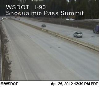
I-90 Snoqualmie Pass Webcam
Snoqualmie Pass I 90

Highway 2 Stevens Pass Webcam
Stevens Pass US 2